Severe Weather Exiting The Region, Storms Chances Return Early Next Week

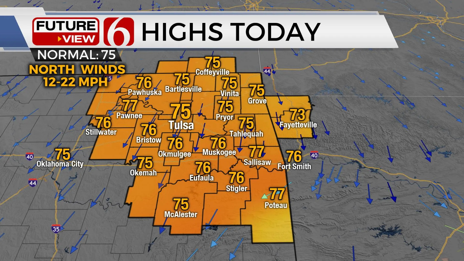
Our storm system that brought severe weather and heavy rainfall to the region is finally exiting the area this morning. Clouds will remain through the morning but slowly decrease from the northwest to southeast later today with highs reaching the mid-70s along with north winds from 12 to 22 mph. Friday looks great with sunshine, north breezes, and highs in the upper 70s. The possibility of a few storms will return to the forecast for part of the weekend before additional storm chances arrive early next week.

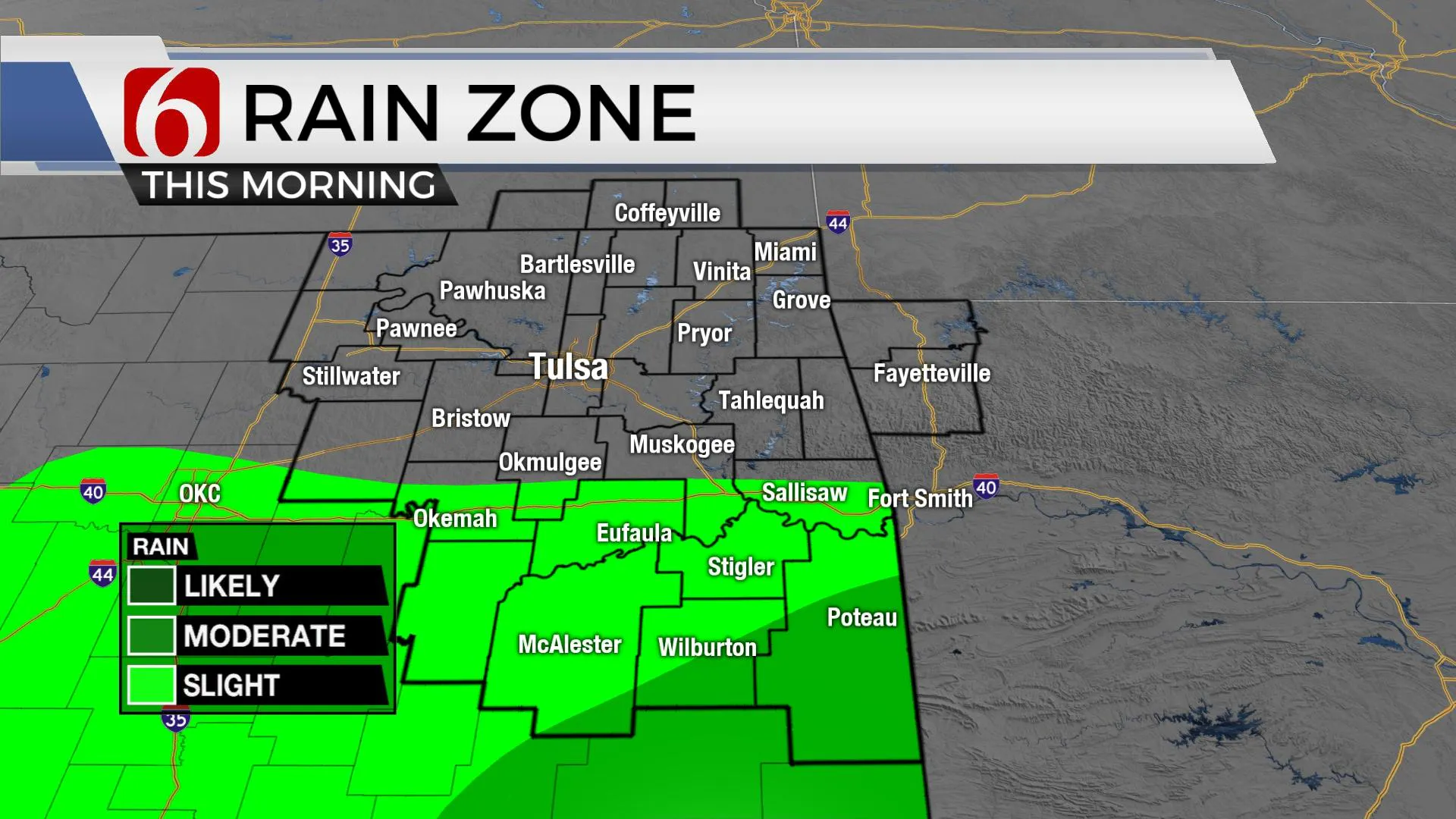
A few lingering showers will remain early this morning across southeastern OK where flood warnings will also continue for the early morning hours. Another small area of showers may parallel the I-40 corridor through the morning hours before ending. Multiple rounds of heavy rainfall over the last 36 hours will keep water levels high before receding later this afternoon. Use caution on flooded roadways. It’s always best to avoid these common, flood-prone areas on your commute. Low water crossings across southeastern and far east-central OK are not viable this morning. Flood warnings will also remain along the Illinois River Basin this morning with moderate to major flooding underway.

The main upper-level system mostly responsible for our active weather has taken a little change compared to previous data. This system will remain closed and drop more southward into the Mexican Plateau tonight before slowly ejecting northeast across part of Texas and Oklahoma this weekend. This could bring a few storms back into southern OK late Saturday evening and possibly into the eastern third of the state Sunday. We have been slowly adding probabilities for these periods and will keep a 30% pop for the metro Sunday with a higher likelihood across southeastern OK. Severe weather threats should be marginal with this system.

Next week, the data is consistent in bringing another upper-level system across the state but inconsistent on the timing. EURO brings this mostly Monday with a surface low moving across the Red River Valley while its GFS counterpart opts for a Monday evening into Tuesday arrival with a cold front. Both sets would bring storm chances but would have some differences regarding the possibility of severe weather threats. Our forecast will continue with storm chances Monday into Tuesday, including the mentions of severe weather, mostly Monday evening.
Thanks for reading the Thursday morning weather discussion and blog.
Have a super great day!
Alan Crone
KOTV
If you’re into podcasts, check out my daily weather update below. Search for NewsOn6 and ‘Weather Out The Door’ on most podcast providers, including Apple, Stitcher, Tune-In and down below on SoundCloud.
