Live Updates: Winter Storm Still Impacting Oklahoma As Round 2 Rolls In

Much of Oklahoma was hit with sleet and ice on Wednesday, which is still affecting road conditions.
Related Story: Winter Weather Coverage Continues Across Green Country
Storm Tracker: News On 6 Storm Tracker Bob Rohloff Is Tracking Road Conditions Near Sand Springs
| Weather Coverage: | Part Of Highway 75 Shutdown Between Glenpool, Tulsa After Crash |
City Of Muskogee Sees Layers Of Ice On Streets, Parking Lots
As another round of winter weather moves into Oklahoma, the News On 6 digital team will update this story with the latest information to keep you informed. The News On 6 weather experts will be in the Bob Mills Weather Center on Thursday with reporters all across Green County as part of our team coverage.
As of 6:00 a.m. on Thursday, February 24th, EMSA has responded to the following weather-related incidents in our Eastern Division Service Area (Tulsa Area):
- 2 Motor Vehicle Accidents
- 2 Cold Exposure Calls
Final weather-related call total for Wednesday 2/23/22:
- 11 Motor Vehicle Accidents
- 8 Cold Exposure Calls
- 9 Slip/Fall Calls
- 1 Carbon Monoxide Incident
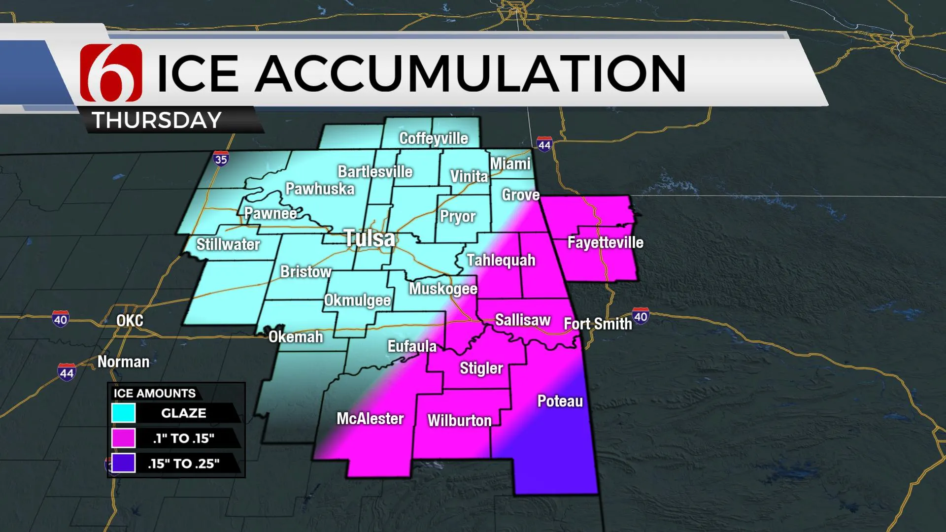
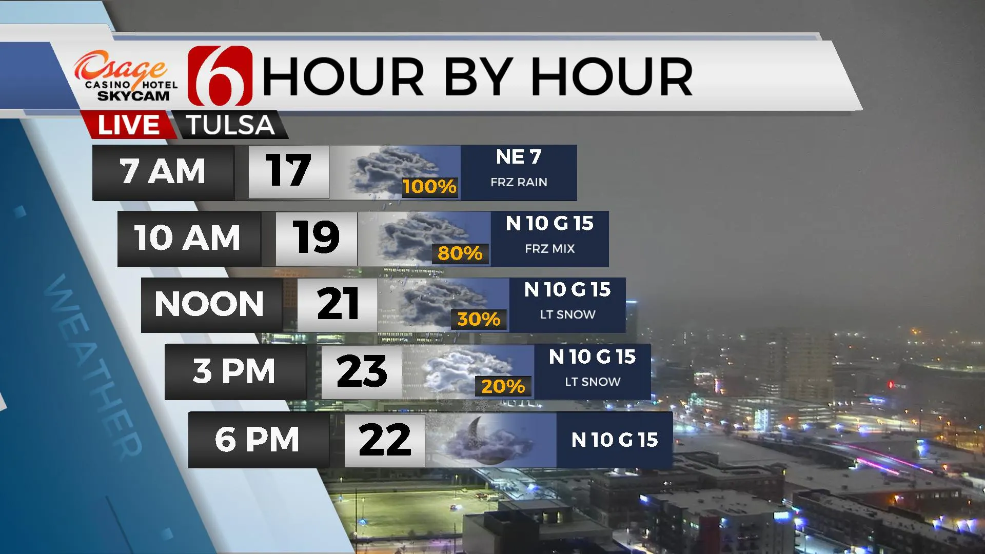
The final wave of this current winter system will exit the area later this morning taking wintry precipitation out of the state by midday to early afternoon. A mix of freezing drizzle and rain will be possible early this morning before changing to light sleet or snow flurries before ending. Any additional accumulation near the Tulsa metro should be light but may continue to cause travel issues. Freezing rain is more likely across southeastern OK into northwestern Arkansas this morning where additional icing from .10 to .20 is possible. Northwest winds from 10 to 15 mph will remain today with single digits wind chills through midday. Temps in the teens this morning will reach the lower to 20s today across northern sections and slightly above freezing across extreme southeastern OK briefly this afternoon.

As the main upper-level trough moves eastward, cloud cover will gradually clear later this evening from the west to east with temps dropping into the lower teens Friday morning near Tulsa with some single digits in the valleys. Partly sunny conditions will be likely Friday with afternoon highs near freezing from the metro north and mid to upper 30s across southeastern OK.

The weekend brings yet another upper-level disturbance across central plains, but the surface reflection of this system is likely to remain across North TX Saturday with showers mostly south of the Red River. There will be a slight chance for some precipitation across southern OK Saturday into early Sunday before this wave exits the region. Temps this weekend feature Saturday morning lows in the lower 20s and afternoon highs in the upper 30s to lower 40s. Sunday morning lows in the mid-20s bring afternoon highs in the mid-50s. Another wave quickly moves near the state Tuesday but with little change in sensible weather. A rather notable warming trend is likely for the latter half of next week with afternoon highs in the 60s and possibly lower 70s.

Thanks for reading the Thursday morning weather discussion and blog.
Have a super great day!
Alan Crone.