Wet, stormy Easter weekend expected in Green Country

A period of active weather will bring multiple rounds of showers and thunderstorms across portions of Oklahoma, beginning later this afternoon and continuing through tonight, Saturday, and Sunday.
Severe storms will be possible, especially later tonight as a slow-moving cold front approaches the area. The primary threats will be large hail and damaging winds. The tornado threat remains low, but not zero.
Friday Afternoon Outlook
South winds at 20 to 30 mph will bring mostly cloudy conditions during the day, with highs reaching the lower 80s. 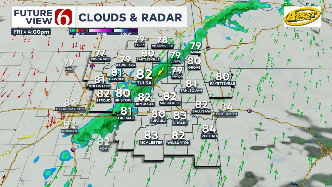 A few elevated showers or storms may develop midday to early afternoon, but higher probabilities for more significant storms, including severe threats, will occur later this evening as the cold front nears the I-44 corridor.
Heavy Rain and Flooding Possible Through the Weekend
As the front moves slowly southward, additional showers and storms will develop near and behind the boundary, leading to pockets of locally heavy rainfall Saturday, Saturday evening, and into early Sunday before shifting out of the area. 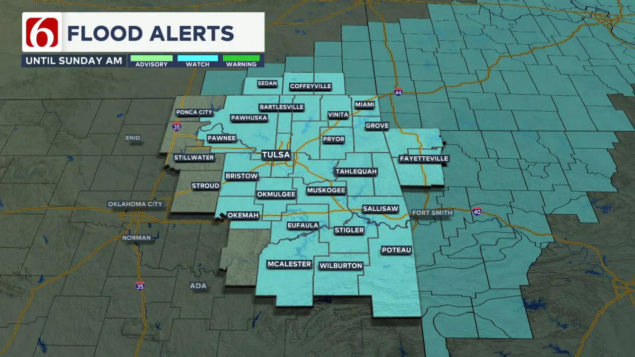 Total rainfall amounts of 2 to 6 inches are possible during this period, prompting a flood watch for most of northern Oklahoma from today through Sunday.
Friday Evening and Overnight Severe Storms
A layer of warm air aloft may suppress storm development ahead of the boundary in southeastern Oklahoma for most of the early evening.
Further west, thunderstorms are expected to initiate from southwestern to central Oklahoma along the boundary, with all modes of severe weather possible.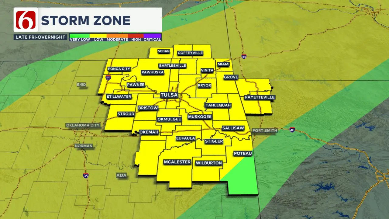 Near and north of the I-44 corridor, elevated supercells could form slightly behind the boundary this evening, bringing large hail, damaging winds, and heavy rainfall.
The timing supports storms beginning to influence the region from 8 p.m. to midnight and then continuing through the overnight hours into early Saturday morning as the boundary is expected to move southward, reaching the I-40 corridor by sunrise slowly.
Some elevated instability will linger behind the front, possibly allowing for a few strong to severe storms through the early Saturday morning hours.
Storms Continue Saturday with Cooler Temperatures
By midday Saturday, the cold front will continue its slow movement southward, with additional thunderstorms developing across southern Oklahoma, including a potential for strong to severe storms south of I-40 by late Saturday afternoon and evening.
Some rain and thunder will continue across most of northeastern OK Saturday afternoon.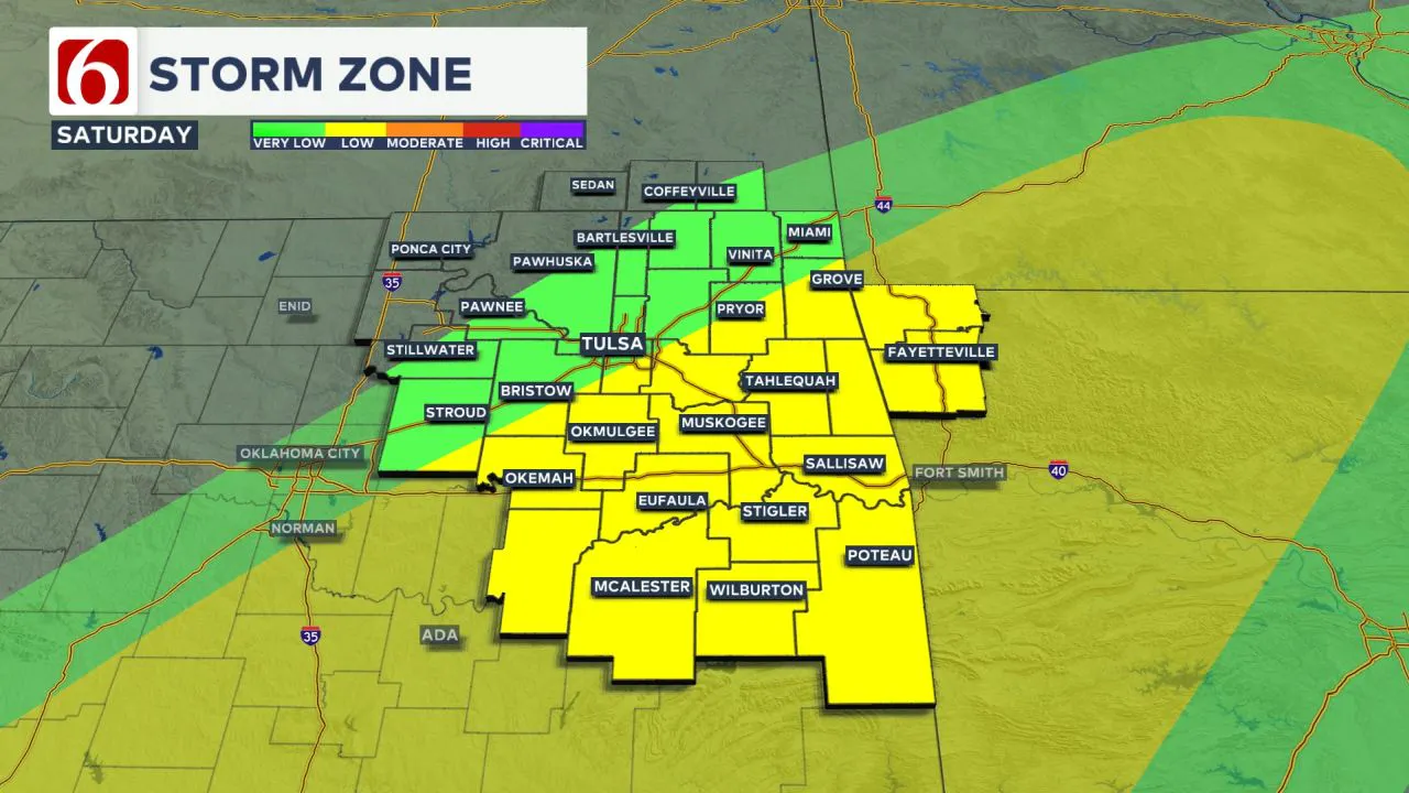
Saturday afternoon temperatures will be in the lower to mid-60s north of the boundary in northern Oklahoma and mid-70s in southeastern Oklahoma.
Renewed Storm Activity Late Saturday Night
By late Saturday night, the main upper-level trough will approach from the west, triggering renewed convection, including pockets of heavy rainfall.
The boundary may briefly lift northward into far southern Oklahoma late Saturday night into early Sunday morning before surging eastward into Arkansas.
Depending upon the exact position of this boundary, a few additional strong to severe storms will be possible early Sunday morning along and east of highway 69.
If the system slows, the severe weather threat could extend more westward than currently expected.
The Easter Sunday Forecast
Most severe weather threats early Sunday should remain across far southeastern OK or along and east of highway 69.
Data suggests showers and storms will remain across most of northeastern and eastern OK Sunday morning through midday before exiting by early afternoon. 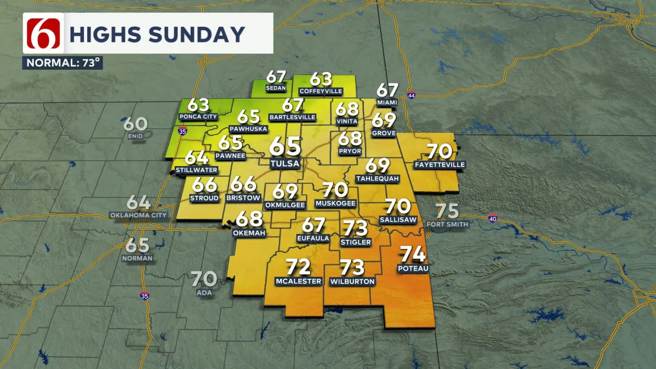
Sunday morning temperatures will be in the mid-50s in the Tulsa metro, with daytime highs in the lower 60s. Slightly warmer conditions are expected across far southeastern Oklahoma, where temperatures may reach near 70 degrees.
Additional Storms Likely Next Week
Mostly pleasant weather is expected Monday and Tuesday, with morning lows in the 40s and 50s, and daytime highs reaching the mid-70s on Monday and upper 70s on Tuesday.
A series of storm systems will impact the state beginning Wednesday of next week, with repeated rounds of showers and storms, including heavy rainfall threats and potential severe weather for several days.
The Morning Weather Podcast:
The daily morning weather podcast briefing will remain on hold indefinitely due to ongoing internal workflow issues.
We're working to resolve these challenges as soon as possible and appreciate your patience. We apologize for the inconvenience and hope to be back soon. Thank you for your understanding.
----
Need-to-know severe Oklahoma weather prep:
🔗Severe weather safety: what you need to know to prepare
🔗Tornado Watch vs. Tornado Warning: what they mean and what to do
🔗Severe weather safety: what to do before, during, and after a storm
🔗Why registering your storm shelter in Oklahoma could save your life
Emergency Info: Outages Across Oklahoma:
Northeast Oklahoma has various power companies and electric cooperatives, many of which have overlapping areas of coverage. Below is a link to various outage maps.
- PSO Outage Map
- OG&E Outage Map
- VVEC Outage Map
- Indian Electric Cooperative (IEC) Outage Map
- Oklahoma Association of Electric Cooperatives Outage Map — (Note Several Smaller Co-ops Included)
Follow the News On 6 Meteorologists on Facebook!