2 storm systems to bring limited rain chances, extreme winds and fire danger

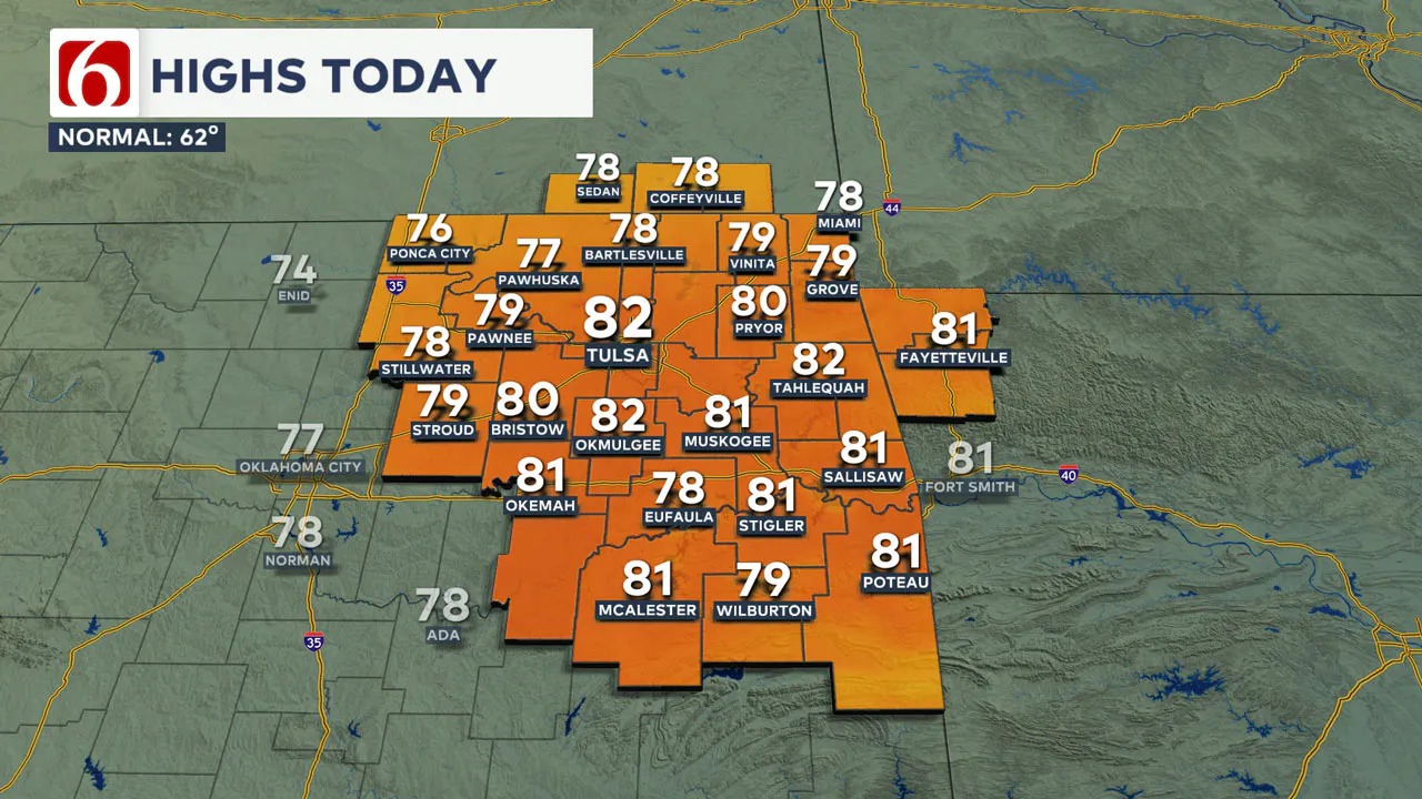
Gusty south winds of 10 to 25 mph will bring temperatures into the upper 70s and lower 80s ahead of a fast-moving storm system.
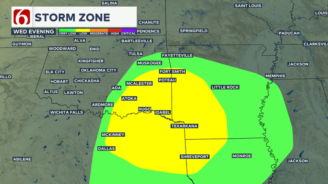
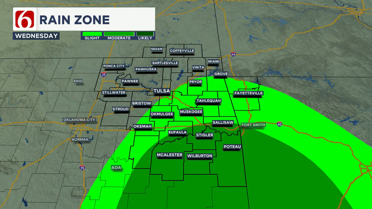
This system could trigger a few scattered thunderstorms mostly across southeastern Oklahoma late this afternoon and evening. If storms develop, a couple may become strong to severe. This threat will move out of eastern Oklahoma between 10 p.m. and midnight.
A much stronger storm system will impact the area on Friday, bringing extremely strong winds and critically high fire danger to much of the region. A cold front will pass through Friday night, with a minor cooldown expected for the weekend.
Any Storms Tonight?
A compact yet strong upper-level wave will move across Oklahoma this afternoon and evening. Ahead of its arrival, low-level moisture will attempt to move from Texas into parts of southern and eastern Oklahoma.
This setup will increase the potential for scattered thunderstorms between 4 p.m. and 10 p.m. tonight, primarily across far southeastern Oklahoma and east-central portions of the state. The probability of storms in the Tulsa metro area remains at or below 20%.
Storms that do develop will likely be severe, with large hail and damaging winds as the primary threats. There is sufficient shear in the atmosphere to support rotating updrafts, meaning the tornado threat, while low, is not zero.
As the system exits between 10:00 p.m. and midnight, winds will relax as a surface ridge of high pressure briefly builds across northern Oklahoma Thursday.
Thursday morning temperatures will start in the upper 40s to near 50, with daytime highs returning to the upper 70s and lower 80s.
Major Storm System to Impact Oklahoma Friday
A powerful storm system is set to influence the central and southern Plains states on Friday. As a strong upper-level wave moves near Kansas, a surface low-pressure system will rapidly develop and intensify through Friday morning into early afternoon.
This low-pressure system will move into southwestern or central Kansas by Friday afternoon. Trailing the low, a dry line—a boundary separating moist air to the east from dry air to the west—will sweep across most of Oklahoma.
Humidity levels are expected to drop to 10% or lower in many locations by Friday afternoon.
The pressure gradient will be very strong, resulting in west to southwest winds of 30 to nearly 55 mph. Some locations across northern Oklahoma and southern Kansas may see wind gusts between 50 and 60 mph Friday afternoon and early evening.
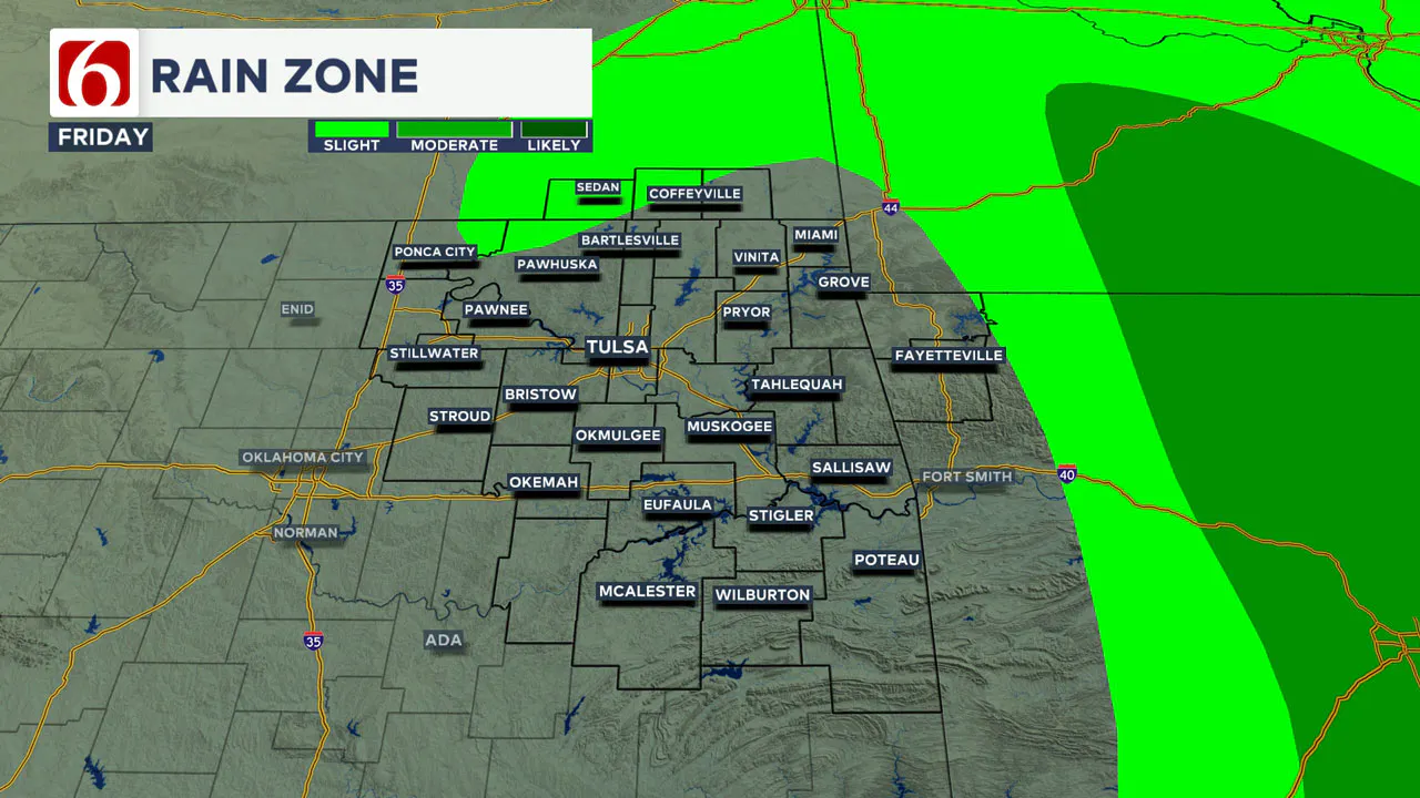
Before the main system arrives, there is a slight chance of a few scattered showers or thunderstorms along the Oklahoma-Arkansas state line.
Short-term data suggests that most of this activity will develop east of our area, primarily in Arkansas. Any storms that form will rapidly move eastward, posing increasing severe threats to neighboring states Friday night.
Fire Danger Issues Will Be Increasing Friday
Fire spread rates Friday afternoon will be critically high. Extreme caution is advised to prevent fires, as environmental conditions will result in erratic and fast-moving fire behavior.
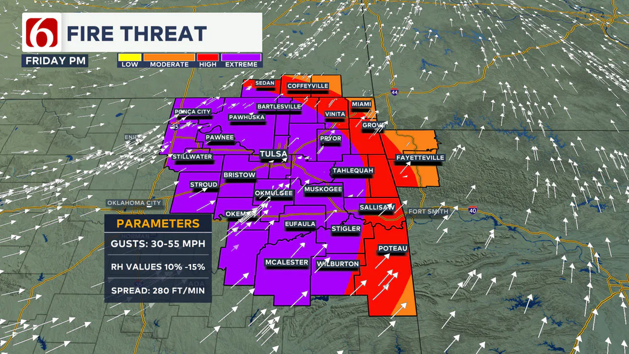
Red flag warnings, high wind warnings, watches, and wind advisories are all likely for parts of Oklahoma and Kansas on Friday.
By Friday evening, a cold front will move in from the northwest. While strong winds will persist, slightly cooler weather will arrive.
How’s the Weekend Outlook?
The weekend looks dry and pleasant. Saturday morning will start with lows in the mid-40s and daytime highs in the lower 60s along with a few clouds nearby.
Sunday morning will be cool, with lows in the mid-30s and highs in the lower 60s.
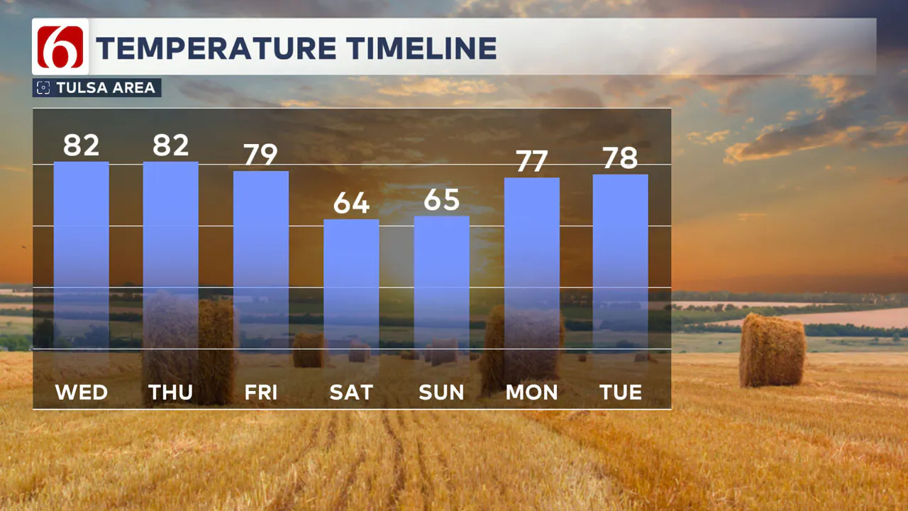
A warming trend returns early next week, with morning lows in the 40s and 50s and highs in the 70s to lower 80s. Severe fronts will cross the state next week but the potential for storms will remain low until low lee moisture returns ahead of these systems.
———
Emergency Info: Outages Across Oklahoma:
Northeast Oklahoma has various power companies and electric cooperatives, many of which have overlapping areas of coverage. Below is a link to various outage maps.
- PSO Outage Map
- OG&E Outage Map
- VVEC Outage Map
- Indian Electric Cooperative (IEC) Outage Map
- Oklahoma Association of Electric Cooperatives Outage Map — (Note Several Smaller Co-ops Included)
The Alan Crone morning weather podcast link from Spotify:
https://open.spotify.com/show/0dCHRWMFjs4fEPKLqTLjvy
The Alan Crone morning weather podcast link from Apple:
Follow the News On 6 Meteorologists on Facebook!
- Meteorologist Travis Meyer
- Meteorologist Stacia Knight
- Meteorologist Alan Crone
- Meteorologist Stephen Nehrenz
- Meteorologist Aaron Reeves
