Oklahoma Weather: Scattered Thunderstorms Expected as Pattern Shifts

A shift in the weather pattern is underway and will bring scattered showers and thunderstorms to parts of the region over the next few days. Increasing cloud cover will help drop temperatures closer to seasonal averages. Rain and storm chances will be highest later this afternoon and tonight before activity moves east by early Friday morning.
We may catch a relative break in precipitation Friday afternoon through part of Saturday, but another wave arriving from the northwest on Sunday could bring additional rain and thunder chances. Looking ahead, yet another storm system may approach by midweek, bringing more clouds, showers, and storms, along with temperatures that stay near seasonal norms.
Any Showers or Storms Today?
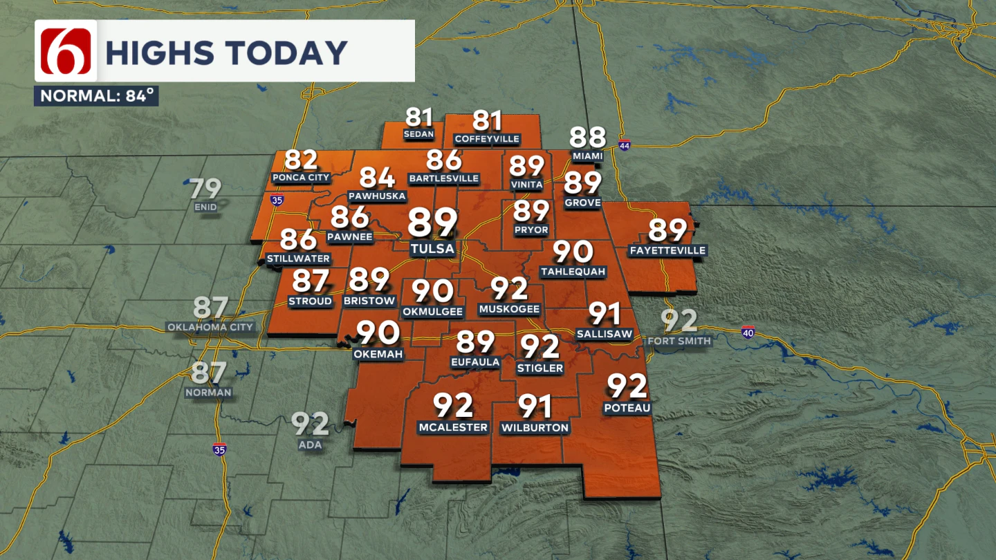
A few thunderstorms are moving into parts of the area this morning, mostly across part of southern Kansas. These are leftovers from storms that developed last night across southwestern Kansas and northwestern Oklahoma. These showers will continue to drift through the region for the next several hours. Most of the area will remain dry this morning but storm chances will pick up later today. 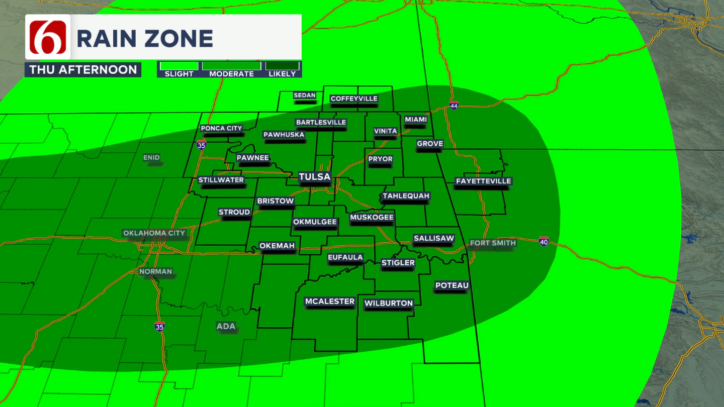 Despite nearby showers and storms, daytime highs are still expected to reach the upper 80s, with a few spots near 90. Winds will become from the north around 10 to 15 mph.
Any Threats of Strong or Severe Storms?
By later this afternoon and evening, additional scattered showers and storms are likely as a residual outflow boundary moves through. A few strong to severe storms are possible, with damaging wind gusts and hail being the primary threats. This graphic is the severe weather risk outlook. 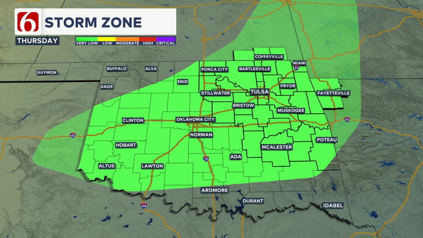 Notice the scale or legend that indicates a very low, but not zero chance of severe storms later today and tonight.
What About Friday?
After early Friday morning, we may see a temporary lull in storm chances. Friday morning lows will be in the mid-60s, with highs in the mid-80s. 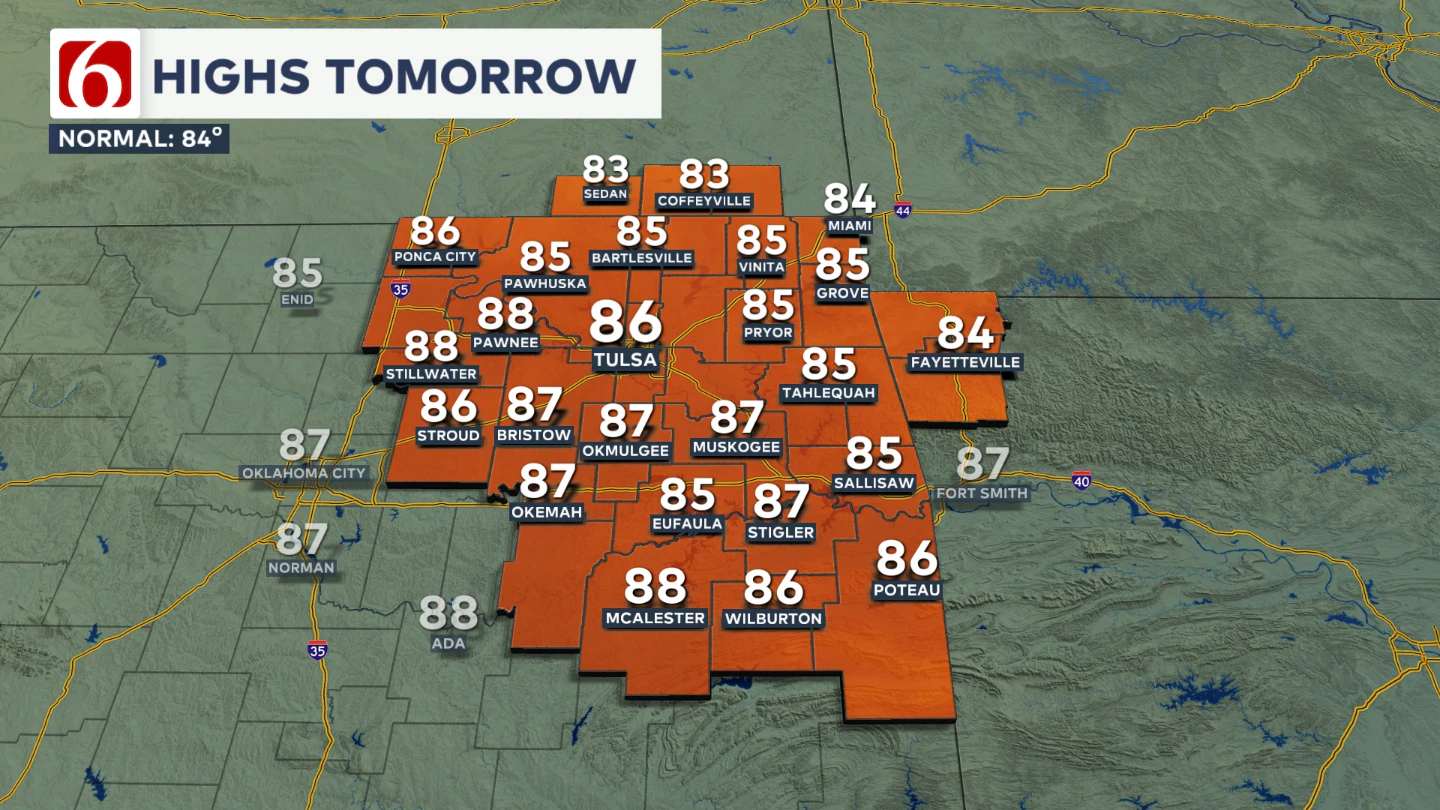 At this point, Friday Night Football games look to have only a very low chance of showers or storms, as the first wave should be exiting to the east. There will remain a very low-end chance of a few showers or storms across far southern Oklahoma Friday evening.
Any Rain Chances This Weekend?
The short answer is yes. But it's mostly a low-end chance for the first part with increasing chances Sunday. The weekend outlook features temperatures near seasonal averages. Morning lows will be in the mid to upper 60s, with Saturday highs in the mid to upper 80s. 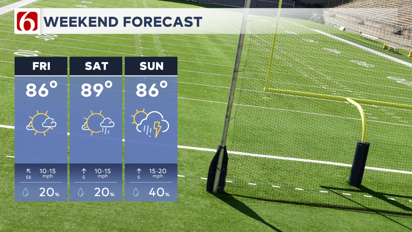 There’s a low-end chance for a shower or storm Saturday, with probabilities staying near or below 30% for most locations.
Could Sunday Bring More Widespread Storms?
By Sunday, the upper-level flow from the northwest will amplify, and another wave of instability is expected to approach the region. Morning lows will be in the mid to upper 60s, with highs holding in the mid-80s. Showers and storms will become more likely during the day, including the potential for locally heavy rainfall and one or two strong to severe storms. Some of this activity may linger into Sunday night and early Monday morning.
What About Next Week?
Early next week, temperatures should remain near or slightly below seasonal averages, with morning lows in the mid-60s and highs in the lower to mid-80s. Models are signaling a possible pattern change next week, but the details remain unclear. A strong Pacific jet will push into the Northwest, with most of that energy likely heading into the northern Plains, while another part of the jet sets up across the southern U.S.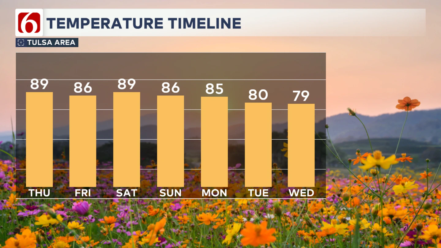
This could aid in the development of an upper low over the central Plains that becomes cut off from the main flow, but models disagree on its exact track. This feature could significantly impact our weather by midweek. Unfortunately, confidence remains low, so we’re watching closely for updates in the coming days.
Football Forecasts
Friday Night Football Across Northeastern Oklahoma: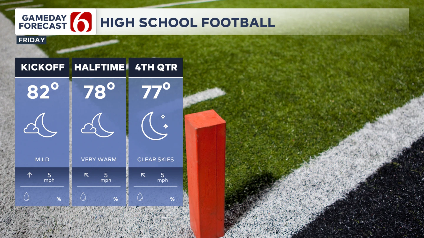
Game time temps will start near 82° and finish in the mid-70s. Most showers and storms should stay away from the immediate area.
Friday Night – Tulsa vs. OSU in Stillwater: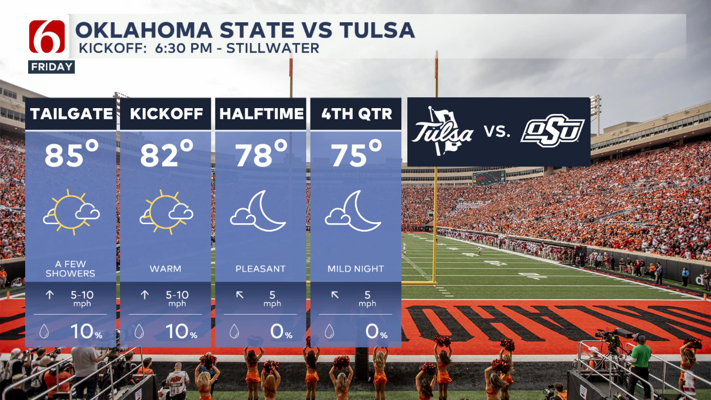
Tailgating temps will be in the lower to mid-80s with a slight chance for an afternoon shower or storm. Kickoff temps will be near 81°, dropping into the mid-70s by the end of the game. Rain chances during the game remain below 20%.
Saturday – Auburn vs. OU in Norman:
Tailgating starts in the mid-70s with a slight chance for a morning shower. Kickoff temps will be in the lower to mid 80s and should stay there throughout the game. Rain chances remain near 20%.
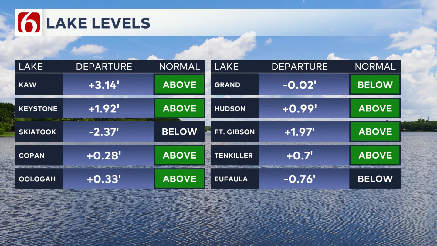
Lake Levels
If you're making some lake recreation plans, here's an update on our area lake levels. You can look up specific lake levels anytime on our website here: https://www.newson6.com/story/5e367cbd2f69d76f6208fbb6/oklahoma-lake-levels
The Illinois River Near Tahlequah 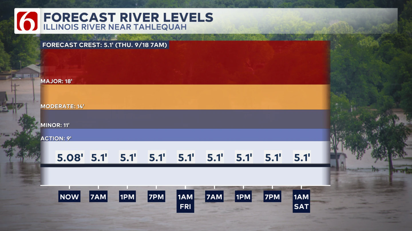
River levels should remain around 5' give or take a little bit though the next few days.
The Morning Weather Podcast:
The daily morning weather podcast briefing will remain on hold indefinitely due to ongoing internal workflow issues.
We're working to resolve these challenges as soon as possible and appreciate your patience. We apologize for the inconvenience and hope to be back soon. Thank you for your understanding.
Hot weather safety:
🔗 Oklahoma heat safety tips: How to spot and prevent heat illness
🔗 Top summer safety tips every family needs to know
🔗 'It can happen to anybody': First responders warn of hot car deaths
Need-to-know severe Oklahoma weather prep:
🔗Severe weather safety: what you need to know to prepare
🔗Tornado Watch vs. Tornado Warning: what they mean and what to do
🔗Severe weather safety: what to do before, during, and after a storm
🔗Why registering your storm shelter in Oklahoma could save your life
🔗Floodwater kills more Oklahomans than tornadoes in the last decade, here's why
🔗'Turn around, don't drown': Flood safety tips for Oklahomans
🔗5 things to know: How Oklahomans can get federal money to install storm shelters
🔗Breaking down the SoonerSafe Rebate Program: Do I qualify for a storm shelter?
Watch us on YouTube
Follow NewsOn6 on X/Twitter for automated severe weather alert posts: @NewsOn6
Emergency Info: Outages Across Oklahoma:
Northeast Oklahoma has various power companies and electric cooperatives, many of which have overlapping areas of coverage. Below is a link to various outage maps.
- PSO Outage Map
- OG&E Outage Map
- VVEC Outage Map
- Indian Electric Cooperative (IEC) Outage Map
- Oklahoma Association of Electric Cooperatives Outage Map — (Note: Several Smaller Co-ops Included)
