Additional strong to severe storms remain possible today and tonight

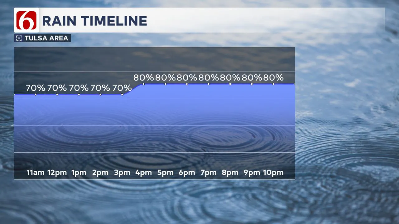
The severe thunderstorm watch that was in effect for parts of the area this morning has expired. Scattered showers and storms will remain likely across portions of the area over the next few hours. Later today and into tonight, additional strong to severe storms will be possible as a weak front slowly moves south and upper-level energy approaches from the southwest
A slow-moving storm system will bring several rounds of showers and thunderstorms across eastern Oklahoma, increasing the potential for locally heavy rainfall and severe weather.
All modes of severe weather are possible today and this afternoon, with large hail and damaging winds being the most likely threats. A low-end tornado risk also exists.
>>>LIVE UPDATES: Severe storms move through Oklahoma
Was there a tornado in Collinsville on Tuesday?
"Yes, it's likely that a brief tornado spun up just after 7 a.m. Tuesday morning as a line of severe storms moved from Owasso into Collinsville," said News On 6 Meteorologist Stephen Nehrenz.
While most of the damage came from widespread 70+ mph winds, radar data and a funnel cloud photo from MaKyla Vent suggest a quick tornado touched down in the Collinsville area. These fast-forming tornadoes can develop and disappear within minutes, often with little or no warning.
The National Weather Service is still surveying the damage to confirm where tornadoes touched down.

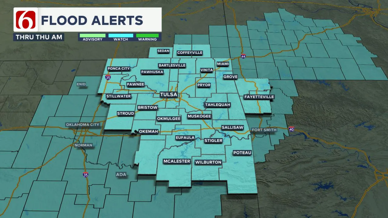
Flood Watch in Effect
The increasing probability of repeated rounds of showers and storms has led to a flood watch being issued.
Areas within and near the flood watch zone could see rainfall totals between 2 to 6 inches, with locally higher amounts.  This could lead to drainage issues in low-lying areas and increase the flooding potential for rivers, streams, creeks, and eventually lakes.
Morning Storms, Afternoon Threat
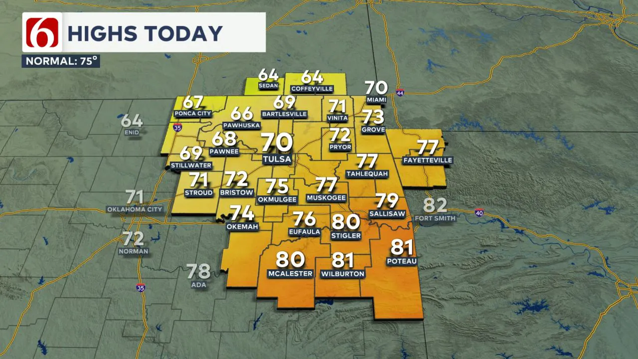
Temperatures this morning will start in the 60s and remain in the upper 60s and lower 70s throughout the afternoon.  Thunderstorms that developed last night are continuing into early this morning as a weak cold front moves south from Kansas into northern Oklahoma, increasing the likelihood of additional showers and storms.
  A strong upper-air flow from the southwest will bring additional dynamic energy to the region this afternoon and early evening, leading to the development of additional strong to severe storms later today and tonight, stretching from southwestern Oklahoma into central and eastern portions of the state by afternoon and evening.
Wednesday Storms and Clearing
By Wednesday morning, lows will be in the lower 60s, with daytime highs reaching the lower 70s.
Thunderstorms are likely to be underway early Wednesday morning as a strong complex of storms moves across part of southern and eastern Oklahoma.
By midday to early afternoon, additional development is possible across southeastern to east central OK, where some additional severe weather threats may be possible.
The main upper-air system will clear the region late Wednesday night into early Thursday morning, allowing another round of showers and storms to move out of the region by early Thursday.
Thursday morning temperatures will be in the upper 50s to lower 60s, with highs reaching the upper 70s.
Low Shower Chances Late Week
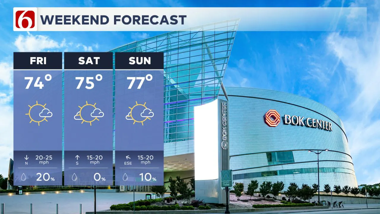
A weak disturbance will pass through Thursday night into Friday, bringing a slight chance for a few showers, though the probability remains low.
A weak cold front will move through on Friday, bringing morning lows in the 50s and daytime highs in the mid-70s.
Another upper-level wave may approach the southern plains by late in the weekend. However, higher chances for storms will arrive by early to mid-next week, including additional severe weather threats.  Saturday morning lows will be in the lower 50s, with highs reaching the upper 70s. Sunday morning temperatures will be in the upper 50s, with highs in the mid-to-upper 70s and lower 80s.
The Morning Weather Podcast:
The daily morning weather podcast briefing will remain on hold indefinitely due to ongoing internal workflow issues.
We're working to resolve these challenges as soon as possible and appreciate your patience. We apologize for the inconvenience and hope to be back soon. Thank you for your understanding.
----
Need-to-know severe Oklahoma weather prep:
🔗Severe weather safety: what you need to know to prepare
🔗Tornado Watch vs. Tornado Warning: what they mean and what to do
🔗Severe weather safety: what to do before, during, and after a storm
🔗Why registering your storm shelter in Oklahoma could save your life
🔗Floodwater kills more Oklahomans than tornadoes in the last decade, here's why
🔗'Turn around, don't drown': Flood safety tips for Oklahomans
🔗5 things to know: How Oklahomans can get federal money to install storm shelters
Watch us on YouTube!
Follow NewsOn6 on X/Twitter for automated severe weather alert posts >>>>>> @NewsOn6

Emergency Info: Outages Across Oklahoma:
Northeast Oklahoma has various power companies and electric cooperatives, many of which have overlapping areas of coverage. Below is a link to various outage maps.
- PSO Outage Map
- OG&E Outage Map
- VVEC Outage Map
- Indian Electric Cooperative (IEC) Outage Map
- Oklahoma Association of Electric Cooperatives Outage Map — (Note Several Smaller Co-ops Included)
Follow the News On 6 Meteorologists on Facebook!